RECOVERY PROJECT: STUDY OF THE RECOLONIZATION OF POSIDONIA MEADOWS IN THE FRENCH MEDITERRANEAN #18
Seagrass beds are ecosystems with major ecological and economic roles, but are in decline worldwide as a result of global climate change and human activities. The need to anticipate both the loss and recovery of seagrass beds is becoming a major social and economic challenge.
The RECOVERY project was launched in 2021 by Andromède Océanologie, in partnership with the RMC Water Agency. It aims to study the phenomenon of seagrass recolonization on large and small spatial scales in the southern region.
Orthography of the herbarium generated by photogrammetry at the Deux frères site (2021). @Andromède Océanologie
The first step was to carry out a large-scale analysis of recolonization areas in the southern region (precise inventory, characterization of physico-chemical conditions and levels of anthropogenic pressure). “Atolls” (circular patches sometimes less dense in their center) were thus highlighted on sonar mosaics acquired in the southern region in 2020 (SURFSTAT network) in 116 areas located between Marseille and Villefranche sur Mer. The surface areas of these recolonization zones are variable, ranging from 767 m² to 44 ha. By modeling certain environmental variables and descriptors of anthropogenic pressures, the recolonization zones observed highlight a link between the presence of “atolls” and certain environmental variables, in particular mean turbidity, depth and surface temperature.
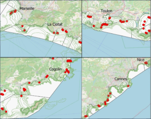
Location of 116 areas of potential seagrass recovery / colonization (in red) observed on sonar mosaics, acquired in April 2020 as part of SURFSTAT (source: Andromède Océanologie, work in progress).
Secondly, a landscape analysis, an assessment of the herbarium’s state of health (vitality parameters) and fine mapping (using photogrammetry) were carried out at ten geographical sites. At one of these sites, the age of the patches was analyzed (radiocarbon dating). Landscape analysis, using several descriptors (surface area of biocenotic data analyzed, surface area analysis, shape complexity index), provides important information on the state of recolonization of the various sites. At this scale, certain indices (decline, fragmentation, aggregation, cover) appear to be effective in differentiating fairly degraded meadows from those whose recolonization process is well advanced after major degradation (bomb, outfall, etc.). The photogrammetries carried out on the meadow patches at the ten sites studied cover between 500 and 1,600 m². Modelled patches vary in size from 0.34 to 121.03 m². The study of the vitality of these meadows showed a good to normal condition at all sites. At the Carqueiranne site, the age of the meadows on the periphery compared with the center of an atoll was determined, indicating equivalent ages.
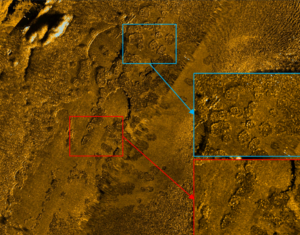
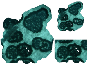
Sonar data acquired in 2020 at the Deux frères site (Var department) showing the atolls (red and blue squares). @Andromède Océanologie
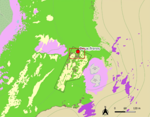
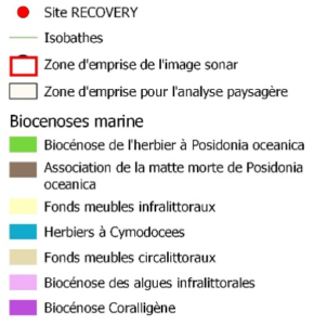
Biocenosis mapping at the Deux Frères site @Andromède Océanologie
The RECOVERY project will continue in 2024-2025 with an analysis of the evolutionary dynamics of the atolls (small scale) and a study of the temporal dynamics of the recolonization zones (large scale).
Gwenaëlle Delaruelle, Andromède Océanologie.