TEMPO, the Posidonia meadow monitoring network
Posidonia, Posidonia oceanica (L.) Delile, is a marine phanerogam endemic to the Mediterranean region. Due to its ecological requirements, it is recognized by the European Water Framework Directive 2000/60/EC (WFD) as an indicator of the quality of Mediterranean coastal waters in the “macrophyte” category. Unfortunately, over the last century, P. oceanica meadows have been severely depleted throughout the Mediterranean basin, particularly around urban centers and large port areas, as a result of excessive anthropogenic pressure. To meet the challenges of the WFD, Andromède océanologie, with the support of the Rhône Méditerranée & Corse Water Agency, set up the TEMPO Posidonia meadow monitoring network in 2011.
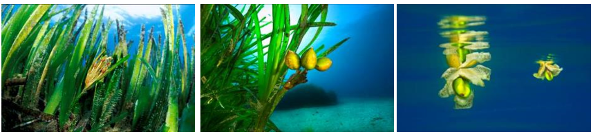
(a) La fleur de P. oceanica ; (b) Trois fruits dans l’herbier ; (c) Graine et fruits de P. oceanica en train de flotter (© Andromède Océanologie)
The TEMPO network covers the entire French Mediterranean coast, bordered by the three regions of Corsica, Provence-Alpes-Côte d’Azur (PACA) and Occitanie. Its mission is to promote the habitat of Posidonia meadows and to monitor long-term changes in their condition. Each site is sampled in late spring (May-June) every three years, with a one-year lag from one region to another. Descriptive data on the health and dynamics of P. oceanica meadows are collected in two characteristic areas: at the lower limit (deepest extension limit) and, since 2014, at the intermediate depth of -15 meters (representative depth of the meadow in the Mediterranean). A total of 96 Posidonia monitoring sites are sampled across the three regions, including 53 sites located at the lower limit of the meadow and 47 sites at the intermediate depth. In 2018, the TEMPO field campaign was carried out in the Occitanie and PACA West regions, between Cap Sicié (Toulon) and Grand Travers (Carnon), at 14 sites at the lower limit and 14 sites at the intermediate depth.
Monitoring of the Posidonia meadow at its lower limit involves three types of measurement: a general description of the site, mapping of the lower limit of the meadow using acoustic telemetry (a method based on the principle of 3D acoustic interferometry), and measurements of the meadow’s vitality. Since 2016, a new mapping method has been used to complement telemetry: photogrammetry. This makes it possible to model the herbarium in 3D using hundreds of 2D photographs taken from different angles.
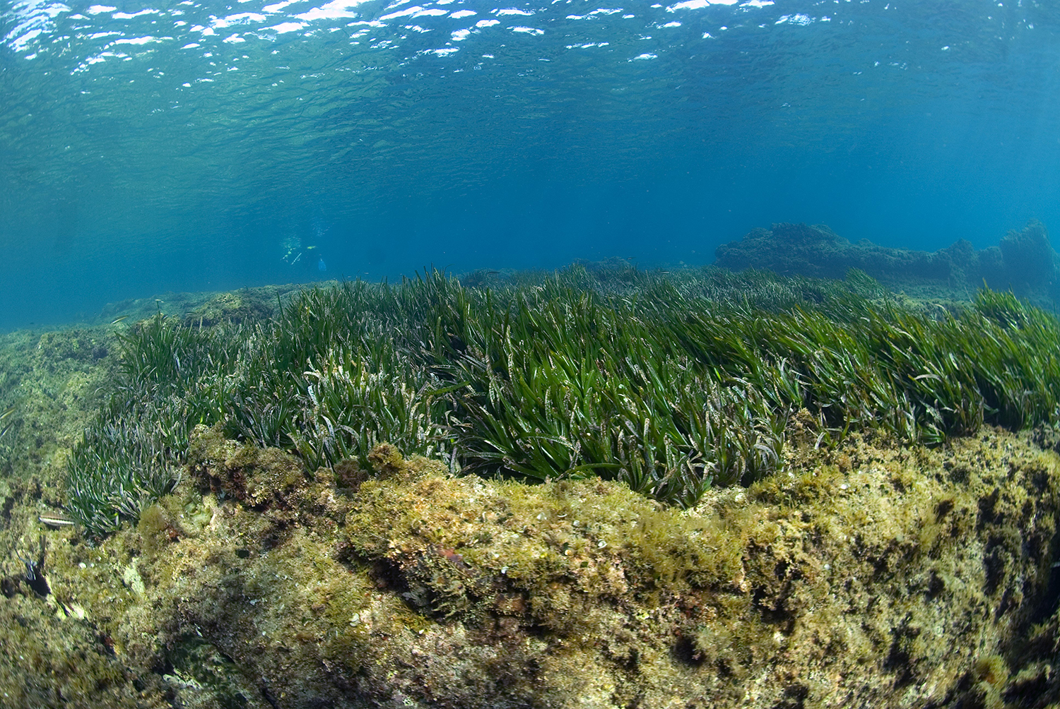
Herbier à P. oceanica photographié sur le littoral méditerranéen (© Andromède Océanologie)
At IP, three indicators are used to characterize the state of health of seagrass beds and thus assess the ecological quality of coastal water bodies: PREI (Posidonia oceanica Rapid Easy Index; Gobert et al., 2009), established in line with WFD requirements and integrated into the TEMPO network in 2014; BiPo (Biotic index based on P. oceanica; Lopez y Royo et al., 2010) and EBQI (Ecosystem-Based Quality Index; Personnic et al., 2014), integrated in 2015. The sites, located at -15m, are in line with existing TEMPO sites at the lower limit of the meadow.
All results for the three indicators at intermediate depth can be consulted on Medtrix in the TEMPO project. A comparison of indicators by year is available via the comparison tool. You will soon be able to access the monitoring data sheets for 2017 in Corsica and 2018 in the PACA/Occitania region by clicking on the different sites (map below). As with other monitoring systems, TEMPO is set to evolve and turn increasingly towards surface indicators deemed more relevant and representative than point-type indicators.
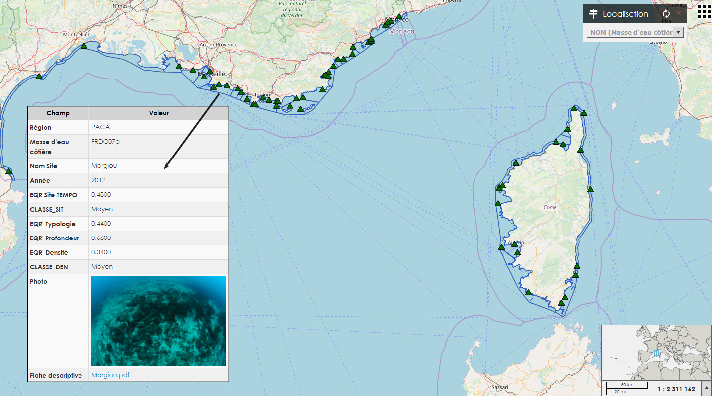
Map data copyrighted openStreetmap contributors and available from https://www.openstreetmap.org (© Andromède océanologie)
Célia Fery, l’Œil d’Andromède