TEMPERATURE MONITORING IN THE FRENCH MEDITERRANEAN
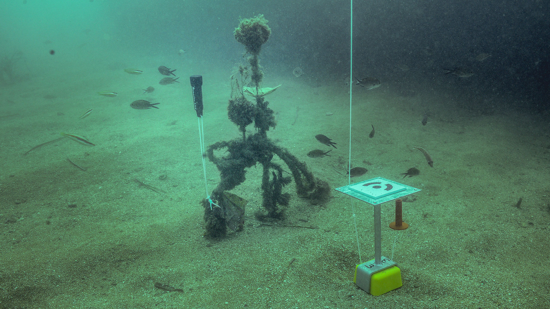
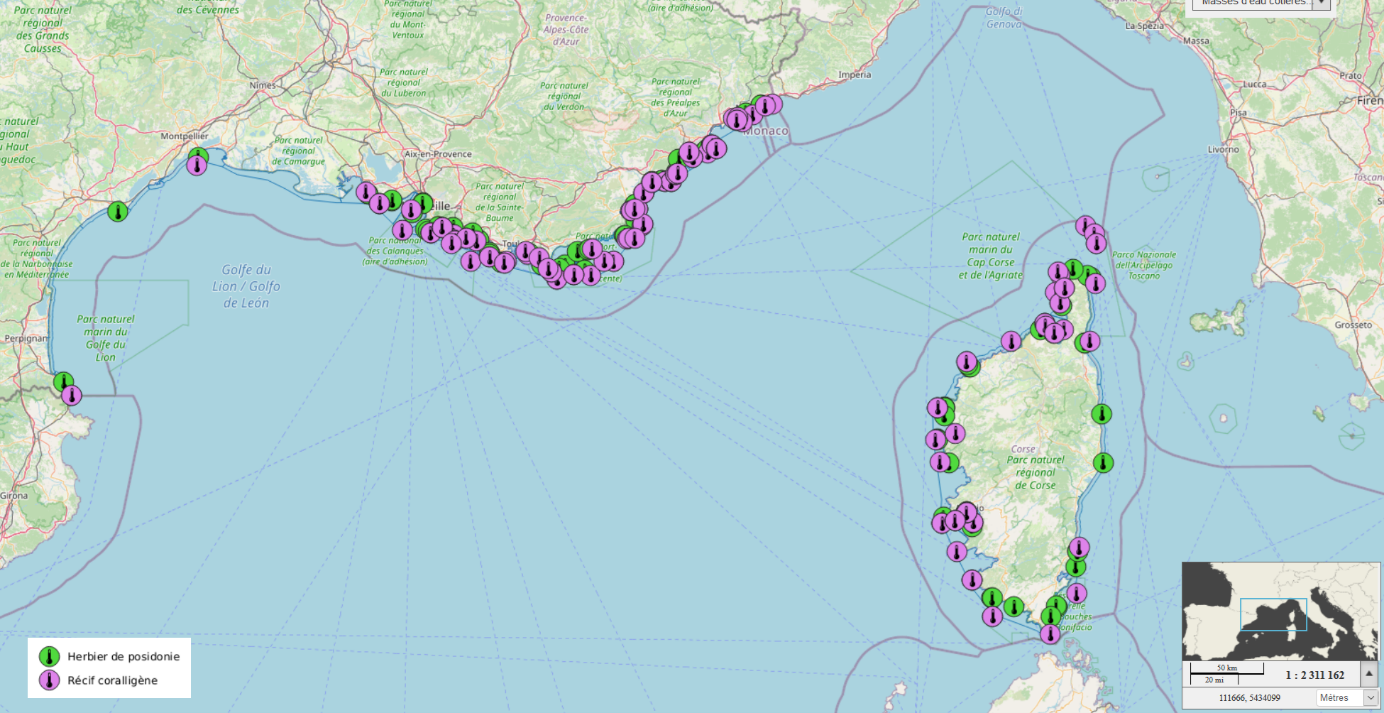
Since 2013, Andromède Océanologie, with the support of the Agence de l’eau Rhône Méditerranée et Corse, has been equipping coralligenous (RECOR network) and Posidonia meadow (TEMPO network) monitoring sites with HOBO Water Temp Pro v2 temperature sensors. 266 sensors (132 RECOR sensors and 107 TEMPO sensors) are currently acquiring data between 4 and 115 meters depth in the French Mediterranean. These sensors will take measurements every 30 minutes for 3 years. Their distribution and the high frequency of measurements enable us to produce bottom temperature maps and correlate biological observations made at TEMPO and RECOR sites with variations in this abiotic parameter.
The installation of temperature sensors started in 2013 on 26 RECOR sites in the Eastern PACA region, and then was completed each year during TEMPO and RECOR monitoring campaigns along the entire French Mediterranean coast. In addition, a field campaign in the Natural Marine Park of Cape Corsica and Agriate (PNMCCA) in July 2020 allowed the installation of 14 sensors on deep coralligenous reefs, between 47 and 115 meters in the park
This study has several objectives :
(1) To carry out in the short term a first modeling of the background temperature on the PACA and Corsica coastline from the sensors recovered following the RECOR (sensors every 5-20km ; one temperature measurement every hour) ; and TEMPO campaigns.
(2) To perpetuate the installation of temperature sensors for long-term monitoring at these depths (between -5 and -70 m) ;
(3) To allow the calibration of physical temperature models by providing reliable high frequency in-situ data over the entire French Mediterranean coastline ;
(4) To correlate observed diversity and vitality data (seagrass and coralligenous) with temperature data.
This will allow us to better understand the biological data, to distinguish between anthropogenic and environmental factors and to predict the impact of climate change on marine biodiversity.
A map of the location of the sensors set up since 2013 can be seen on the platform, by clicking on the « Access the maps » button, just below.
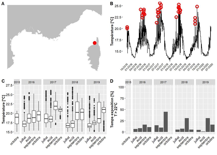
Example of a graph available on Medtrix for the Agriates 37 m site (TEMPO). A. Location, B. Temporal evolution of temperature (daily average), with temperature anomalies in red, C. Statistical distribution of temperatures, D. Percentage of time spent above 22 °C
Contact : Guilhem Marre
Project leader: Andromède Océanologie
Update frequency: One monitoring per year per region (each region, Occitanie/PACA West, PACA East and Corsica, is monitored every three years).
Partners: Rhone Mediterranean and Corsica Water Agency and OSU-OREME
Study reports

Related scientific publications
/