OBSERVATORIES SOCIO-ECONOMIC OBSERVATORY OF COASTAL AND MARINE USES
The OSEMED observatory was initiated in 2009 through a partnership between IRSN and the RMC Water Agency. It aims to acquire recurrent information on the socio-economy of coastal and marine uses on the scale of the Mediterranean coastline. The data of the observatory are updated every 5 to 10 years through the realization of a specific study which integrates a methodology and very precise indicators.
The construction of the observatory is based on the “socio-economic” component of the CLARA 2* project (choice of methods, monitoring indicators, space-time scale, etc.). This project has made it possible to obtain a first set of data on the socio-economy of the coast and the sea on the scale of the coast and to define the basis of the observatory. The information acquired was updated and the methods consolidated in 2014 as part of a work conducted by the University of Versailles (UVSQ-CEARC) in partnership with IRSN-SESURE and with the support of the RMC Water Agency.
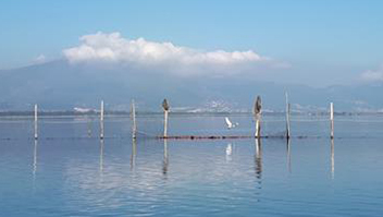
Seven socio-economic activities directly related to the quality of the marine environment are evaluated within the observatory : professional fishing, aquaculture, marinas, yacht clubs, club diving, sea walks and leisure activities (swimming, underwater trails, leisure fishing, etc.) as well as two activities benefiting from the proximity to the sea : accommodation and catering in the coastal municipalities of the nearby catchment areas
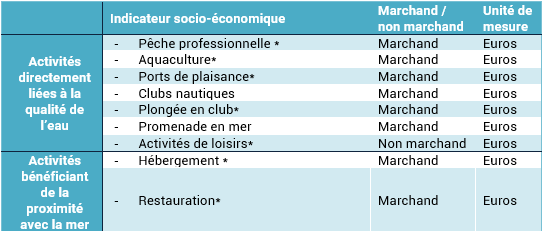
➔ Table 1. Market and non-market socio-economic activities of the Mediterranean coastline evaluated in this study
For each of these activities, a monetary evaluation by zone is carried out based on the calculated or estimated turnover and according to the available data.
• For commercial activities, economic data is collected from all available sources of information : bibliographic studies, national or regional databases (INSEE, Ifremer, professional federations, etc.), and direct surveys of local stakeholders. Particular attention is paid to avoid double counting by accurately identifying the data sources of the aggregated information.
• For non-market activities or those that include a non-market component, the turnover is estimated using the Contingent Valuation Method (CM). This method is based on a collection of information from institutions and a survey of users to assess their willingness to pay (WTP) for access to good quality water. This method seeks to make the agents reveal (more or less directly) the value they place on environmental goods and services.
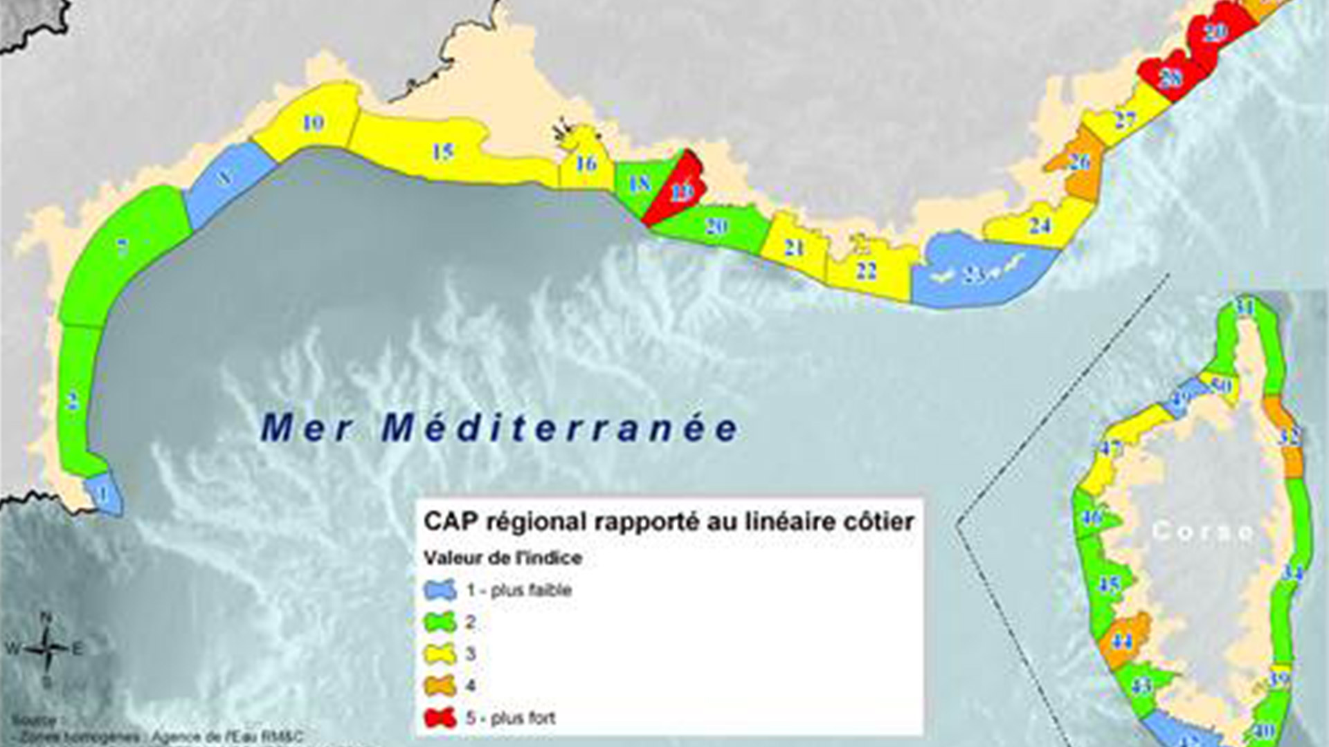
All the data (market and non-market) is accessible at the scale of homogeneous zones and on the whole Mediterranean coast. Homogeneous zones are coherent units of coastal management which, like river basins, constitute an optimal geographical scale of work for an integrated approach to the management, restoration and exploitation of the coastal fringe. The SDAGE identifies 50 homogeneous zones for the Mediterranean coastline (see map in the study report accessible below the legend).
For each coastal activity, the data collected for the 50 zones are discretized and grouped into 5 sensitivity classes corresponding to a color code ranging from blue (less economically sensitive) to red (more economically sensitive). The conversion of economic values into indices allows the comparison of the study areas between them, despite the heterogeneous units of measurement (physical units and monetary units). The natural threshold method, also known as the Jenks method (1967), is used to perform this conversion and to develop the maps. This method consists of creating boundaries by minimizing the subclass variance and maximizing the interclass variance. In other words, the areas within a class have economic values that are as little dispersed as possible (they are homogeneous) and the indices are as far apart as possible (they are heterogeneous). This method was applied to all monetizable and non-monetizable indicators.
To visualize the results, you can click on the “Access the maps” button below to access the platform directly
Contact : Cathy-Anna VALENTINI (CathyAnna.VALENTINIPOIRIER@eaurmc.fr)
Project Leader : Agence de l’eau Rhône-Méditerranée et Corse – http://www.eaurmc.fr
Update frequency : Every 5 to 10 years
Partners : Rhône Méditerranée and Corse Water Agency, IRSN, University of Versailles (UVSQ-CEARC)