DETAILED MAPPING OF MARINE HABITATS
Seabed mapping represents a challenge for the knowledge and management of marine ecosystems whatever the spatial scale considered (understanding of global phenomena on a large scale such as the impact of anthropogenic pressures on marine ecosystems, management of a territory, a marine protected area, or a specific habitat on a finer scale). It is also the basis for more direct applications such as the analysis of ecological and spatio-temporal heterogeneity of environments from surface indicators (project ‘SURFSTAT’) or the development of a smartphone / tablet application as a management tool (project ‘DONIA’).
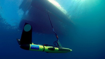
The creation of the first continuous mapping of marine habitats carried out by Andromeda Oceanology in 2014 required, following the synthesis of existing data (30 years of work compiled), various field campaigns in the French Mediterranean. The objective of these campaigns was to fill the gaps in existing data by: (1) an update of the shallow waters over the entire French Mediterranean coastline based on aerial photographs; (2) bathymetric (GeoSwath multibeam echosounder) and sonar (Klein 3900) acquisition campaigns for deeper waters (<-15 meters); (3) ground-truthing campaigns to validate the pre-mapping of marine habitats. Observations were made through spot dives and towed diver transects, a method that allows the field validation of several thousand points by a biologist diver along transects that can reach up to 10 km per day of acquisition. Following the completion of this first continuous mapping of marine habitats, various bodies of water have been updated and/or mapped in 2015 / 2016 / 2021 (Corsica region) and in 2018 / 2020 (Southern region, especially sectors impacted by anchoring). In connection with the SURFSTAT network for surface analysis of marine habitats, the biocenotic data of coastal water bodies are therefore updated at different time steps (three, six, nine years), particularly with regard to the anthropic pressures they are subject to, and updated in the DONIA Expert project. The latter also integrates all the recent cartographic data transmitted by other entities (local authorities or managers of marine protected areas for example).
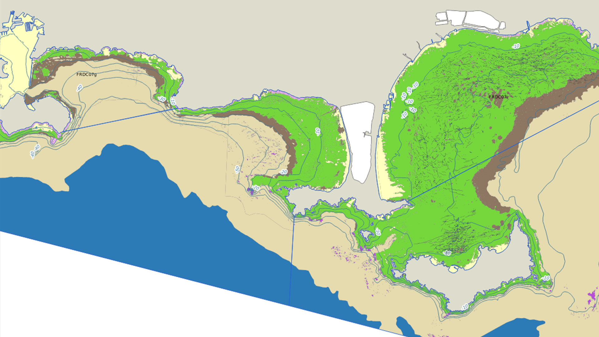
In this project is visible the continuous mapping of the French Mediterranean marine biocenoses (all regions taken together = 1700 km of coastline and 47 coastal water bodies), with a precision of 1/10,000th between 0 and 80 meters, as well as in the region of Liguria and some Small Mediterranean Islands (cf. PIM project): the Archipelago of Galite and the Island of Zembra (North of Tunisia) and the Island of Tavolara (Northeast of Sardinia). It includes 15 habitat classes: Biocenosis of the Posidonia oceanica meadow, Association of the dead matte of Posidonia oceanica, Biocenosis of infralittoral pebbles, Infralittoral soft bottoms, Zostera noltei meadows, Cymodocea meadows, Circalittoral soft bottoms, Biocenosis of infralittoral algae, Coralligenous biocenosis, Offshore rock biocenosis, Bathyal rock biocenosis, Artificial habitats, Bathyal zone, Mixed seagrass beds with Zostera noltii, Zostera marina, Cymodocea nodosa and Ruppia cirrhosa and Rhodolith association on coastal detritus.
The user can display on the map, independently of the biocenoses, the isobaths (up to about 100 meters depth) and the mooring tracks (layer available for the Hyères roadstead and the Gulf of Saint-Tropez, made from sonar data).
This work is licensed under a Creative Commons Attribution-NonCommercial-NoDerivs 3.0 Unported License.
Contacts : Agathe Blandin (agathe.blandin@andromede-ocean.com) / Gwenaëlle Delaruelle (gwenaelle.delaruelle@andromede-ocean.com)
Project Leader : Andromède Océanologie – www.andromede-ocean.com
With the contribution of the following structures, for the biocenosis data: AMP de la côte Agathoise; Andromède Océanologie; Agence de l’Eau Rhône-Méditerranée et Corse; Area Marina Protetta Capo Carbonara; Area Marina Protetta Tavolara; ASCONIT Consultants; Association Œil d’Andromède ; COMEX-SA; Communauté de communes du Golfe de St Tropez; Compilation OFB, 2019 selon données Seaviews/Biotope – AFB 2018 et Andromède Océanologie (SHOM, IGN, AAMP, Fugro, Andromède Océanologie)- DIREN LR 2008 – AAMP 2012 ; Conservatoire du Littoral; Créocéan; DREAL PACA; EGIS EAU; EPHE; ERAMM; EVEMAR; Expéditions Gombessa; GIS POSIDONIE; Hellenic Centre for Marine Research; IFREMER; Institut Balear de la Natura; Institut océanographique Paul Ricard; IN VIVO; Nice Côte d’Azur; OFB (Etude SANDRO, 2021-2023); Parc Marin International des Bouches de Bonifacio; Pasqualini; Programme CARTHAM – Agence des Aires Marines Protégées; Programme MEDBENTH; Programme SURFSTAT; P2A / SUBCMARINE; Sintinelle; Stareso; Région Ligurie; Toulon Provence Méditerranée; Université de Corse (EQEL); Ville d’Agde; Ville de St Cyr sur mer; Ville de Cannes; Ville de Marseille; Ville de St Raphaël; Ville de St Tropez.; P2A Développement; SubC-MARINE; OFB-PNMGL
Update frequency: Annual for the project; 1 to 6 years depending on the sector for the mapping.
Last update of the cartography: June 2022.
Partners: Rhône Méditerranée and Corse Water Agency, NAOS.
Associated scientific publications
• Mapping biodiversity in three-dimensions challenges marine conservation strategies (Doxa et al., 2015)
• Impact of 85 years of coastal development on seagrass beds (Holon et al., 2015a)
• Fine-Scale Cartography of Human Impacts along French Mediterranean Coasts (Holon et al., 2015b)
• A predictive approach to benthic marine habitat mapping (Vassallo et al., 2018)
• Préservation des posidonies: les ressorts d’une collaboration efficace (Julie Deter et al., 2022)
• Spatially Explicit Seagrass Extent Mapping at 10 m Across the Entire Mediterranean