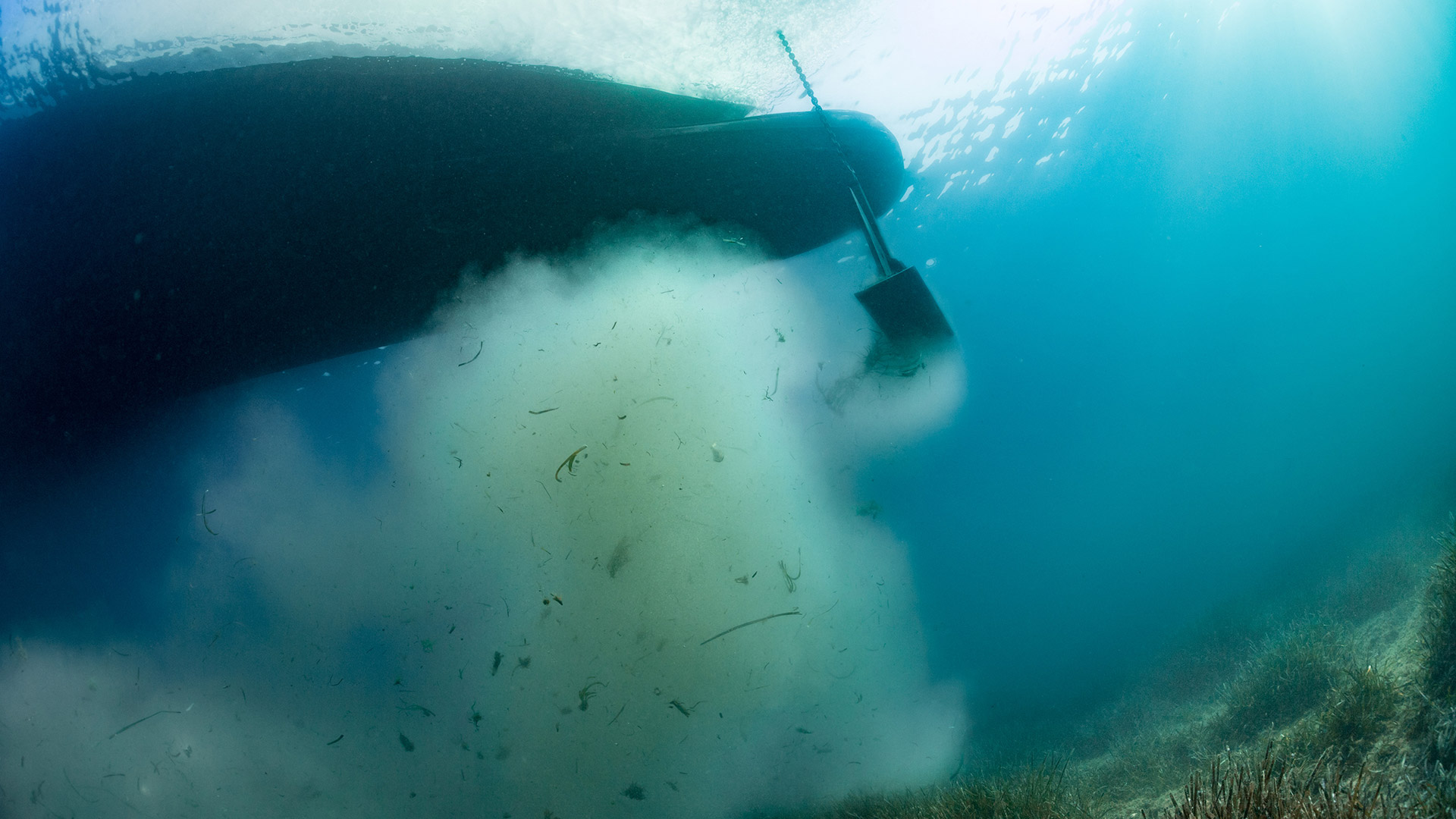
BOAT MOORING
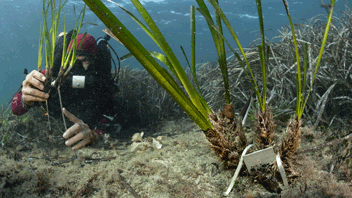
Boat mooring is responsible for physical damage to sensitive marine habitats such as sea grass beds. To avoid conflicts of use and to facilitate the management of these impacts, it is essential to locate and quantify the areas under anchoring pressure. AIS (Automatic Identification System) data can be used to estimate this pressure on the coastal marine habitats of the French Mediterranean.
AIS are navigation safety tools that have been mandatory since the end of 2004 on board vessels over 300 tons engaged in international waters and vessels over 500 tons not engaged in international waters, and for all commercial vessels carrying passengers, regardless of size, for safety reasons (International Marine Organization (IMO), 2016).
To track anchoring pressure along the French Mediterranean coast, researchers at Andromède Océanologie analyzed AIS data from 2010 to the present day. Between 2010 and 2024, this represents fifteen years of data, including 38328 ships for 352986 anchorages, of which 168494 anchorages were for boats over 24 meters in size, and 184492 for ships under 24 meters.
The data presented in this project concern :
– the location of AIS anchorages between 2010 and today classified by year and boat size class.
– regulatory data
– mapping of sensitive ecosystems (coralligenous reefs, Posidonia meadows and dead matte)
– a map of the pressure of anchoring due to large yachts (boats > 24 meters long) between 2017 and 2018, and between 2019 and 2020, as well as a map of the pressure of anchoring by small yachts (boats < 24 meters long) between 2019 and 2020.
Contacts : Florian Holon/ Thomas Bockel (Thomas.bockel@andromede-ocean.com)
Project Leader : Andromède Océanologie – andromede-ocean
Source des données : AIS : Marine traffic, Vesselfinder, Aishub
Update frequency : Annual
Partners : Rhone Mediterranean and Corsica Water Agency
With the contribution of the following structures, for the biocenoses data : AMP de la côte Agathoise ; Andromède Océanologie ; Agence de l’Eau Rhône-Méditerranée et Corse ; Area Marina Protetta Capo Carbonara ; Area Marina Protetta Tavolara ; ASCONIT Consultants ; Association Œil d’Andromède ; COMEX-SA ; Communauté de communes du Golfe de St Tropez ; Compilation OFB, 2019 according to data Seaviews/Biotope – AFB 2018 and Andromède Océanologie (SHOM, IGN, AAMP, Fugro, Andromède Océanologie)- DIREN LR 2008 – AAMP 2012 ; Conservatoire du Littoral ; Créocéan ; DREAL PACA ; EGIS EAU ; EPHE de Perpignan (2014) ; ERAMM ; EVEMAR ; Gombessa 5 Expedition ; GIS POSIDONIE ; Hellenic Centre for Marine Research ; IFREMER ; Institut Balear de la Natura ; Institut océanographique Paul Ricard ; IN VIVO ; Nice Côte d’Azur ; Parc Marin International des Bouches de Bonifacio ; Pasqualini ; CARTHAM Program – Agence des Aires Marines Protégées ; MEDBENTH Program ; SURFSTAT Program ; Sintinelle ; Stareso ; Liguria Region ; Toulon Provence Méditerranée ; University of Corsica (EQEL) ; City of Agde ; City of St Cyr sur mer ; City of Cannes ; City of Marseille ; City of St Raphaël ; City of St Tropez.
Associated scientific publications
• Boat anchoring pressure on coastal seabed using AIS data (Deter et al., 2017)
• Cahier de la surveillance MEDTRIX n°6 – édition spéciale : Impact du mouillages des grands navires en Méditerranée française.
• Préservation des posidonies: les ressorts d’une collaboration efficace (Deter et al., 2022)
• Anchoring pressure and the effectiveness of new management measures quantified using AIS data and a mobile application. Marine Pollution Bulletin (Bockel T, Marre G, Delaruelle G, et al, 2023)