APPLICATION OF PHOTOGRAMMETRY TO BIOLOGICAL MONITORING OF UNDERWATER HABITATS
Photogrammetry allows, from the assembly of many photographs (2D) taken from different angles, to reconstruct an object in three dimensions (3D). This method, used since 2016 in the framework of the RECOR (coralligenous assemblages monitoring network) and TEMPO (Posidonia meadows monitoring network) networks, allows the fine reproduction in 3D of underwater landscapes.
The development of photogrammetry applied to the monitoring of marine ecosystems improves the quality and quantity of data collected in situ, and opens the way to the development of new ecological indicators. By comparing them over time, the 3D models will show the state of conservation or degradation of marine ecosystems.
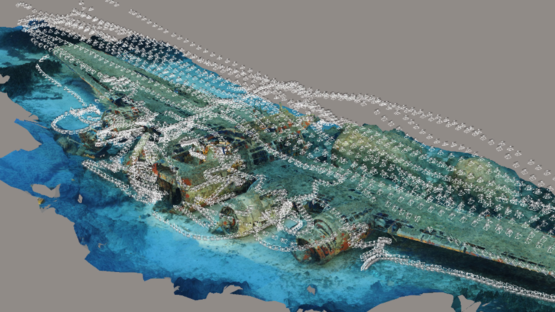
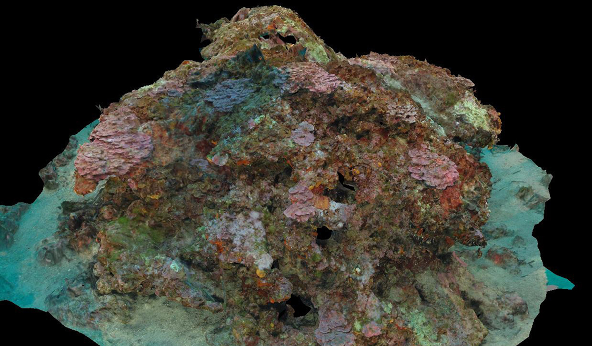
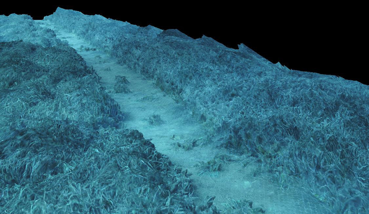
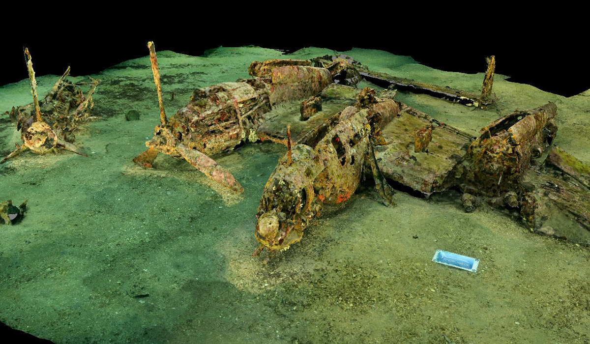
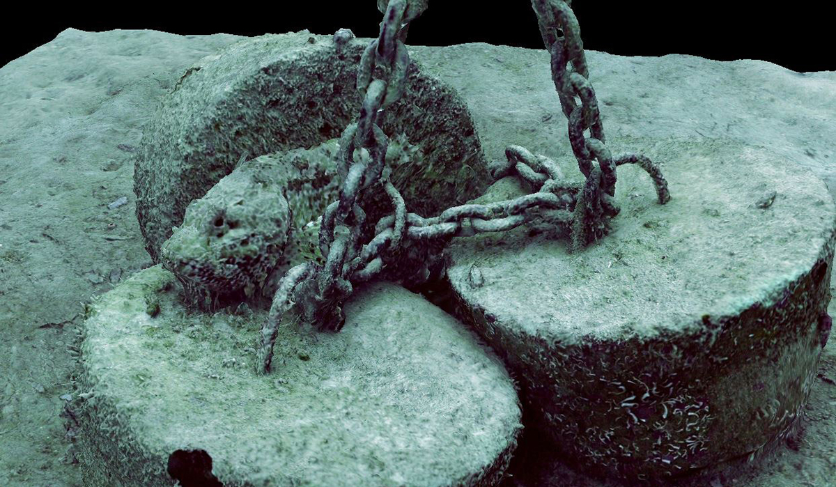
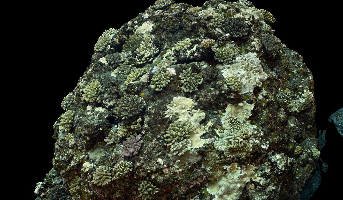
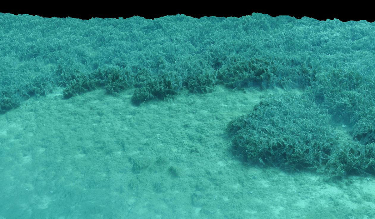
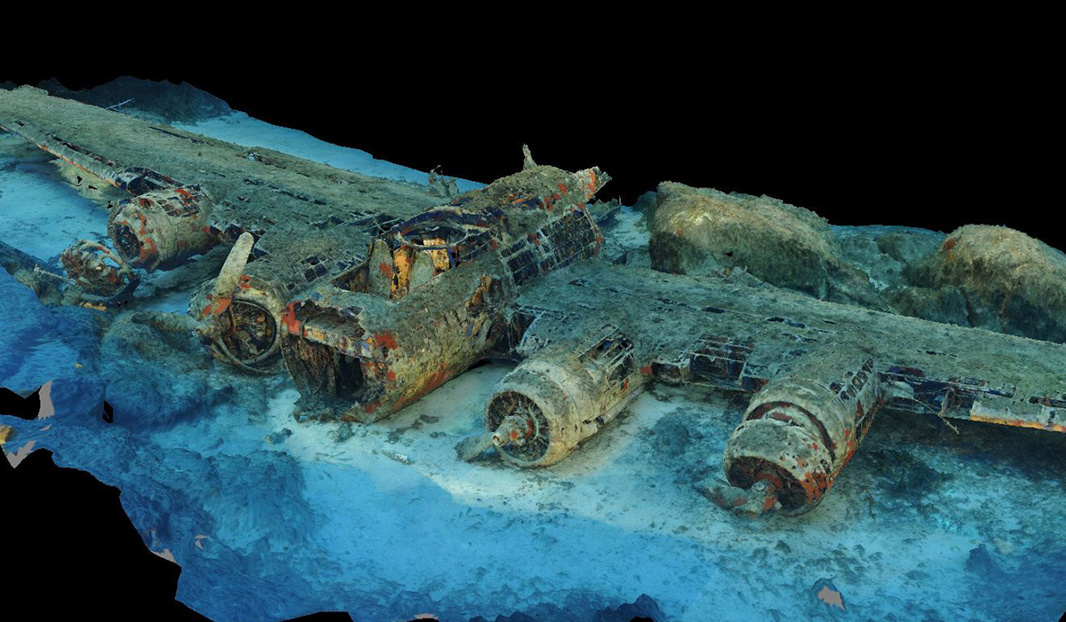
The MODEL project, operated since 2016 by Andromède océanologie with the support of the Rhone Mediterranean and Corsica Water Agency, allows the visualization of the different 3D models made in the framework of the TEMPO (159 models) and RECOR (177 models) monitoring networks, and of the REXCOR restoration projects at Cortiou (32 models) and RESCOR at Cap Ferrat (13 models). The 3D models of several coralligenous reefs made during the Gombessa V and VI mission in 2019 and 2021 (Laurent Ballesta & Co.) are also available, as well as three remarkable wrecks : the B17, the P38 and the ancient wreck, known as “The Titanic.”
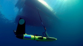
The images are acquired according to a protocol defined from the conclusions of a study published in 2019 (see references below). For posidonia meadows, parallel transects are made at 2.5 m from the bottom, ensuring an axial coverage > 80% and lateral > 60%. For coralligenous reefs, images are acquired at 1.5 – 2 m from the reef with two off-set flashes, in transects around the reef with shots perpendicular to the surface locally.
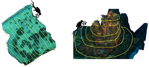
Acquisition trajectories in the case of a Posidonia meadow (left) or a reef (right).
The use of a test chart with the 4 cardinals, oriented in space thanks to a compass and a precision spirit level, makes it possible to scale and orientate the models during their production.
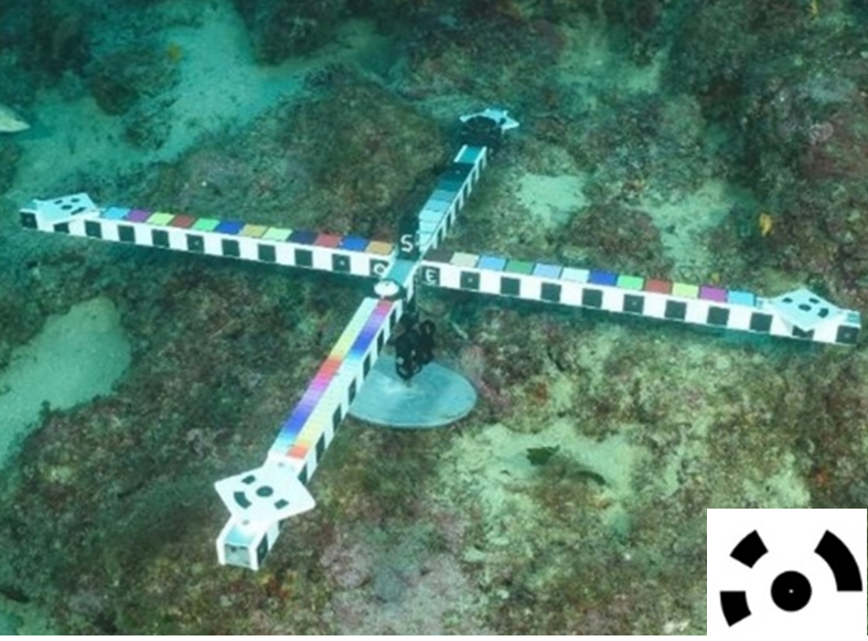
Indeed, the coded markers placed at the ends of the sight are automatically recognized by the reconstruction software and serve as a control point to orient and scale the models.
<- Photogrammetric test pattern with the 4 coded markers recognized by the software
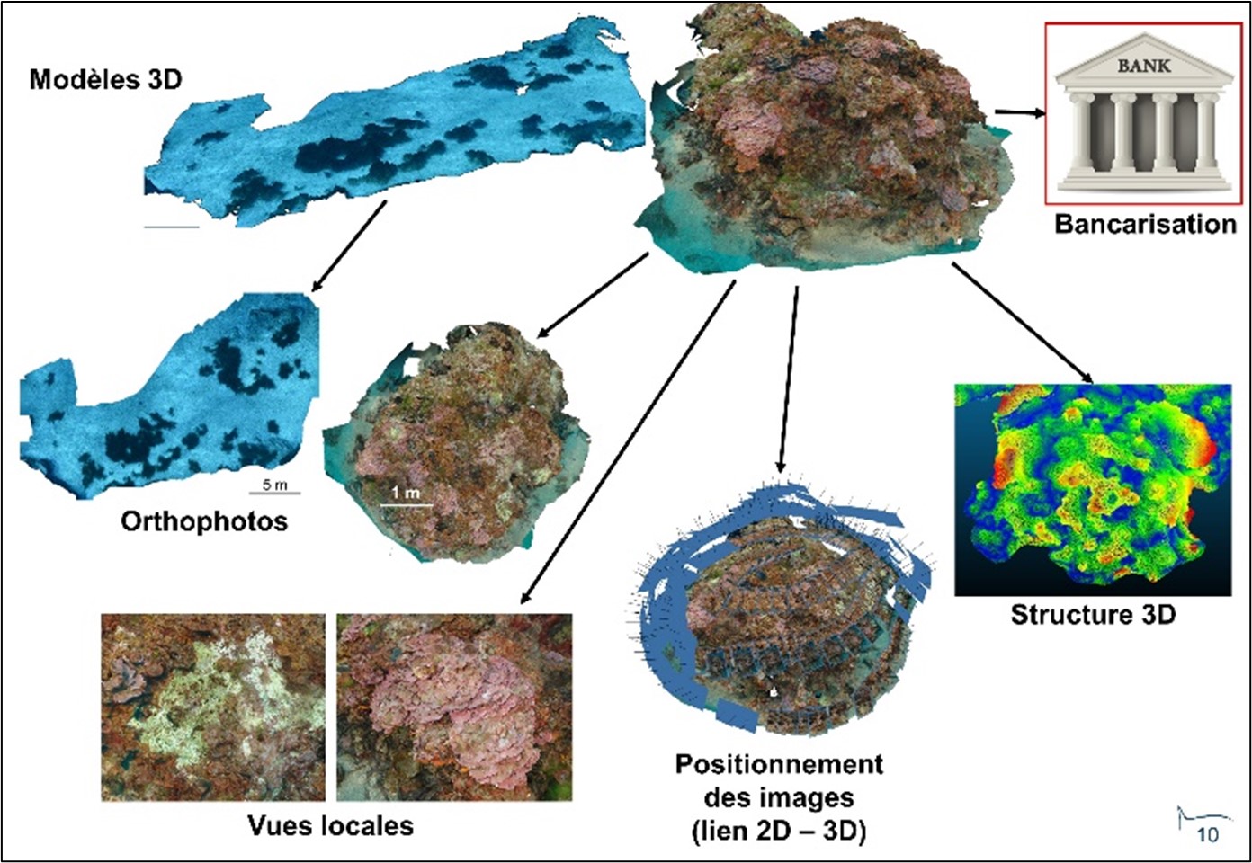
The photo sets are processed to produce the 3D models. The following figure illustrates schematically the different stages of model production :
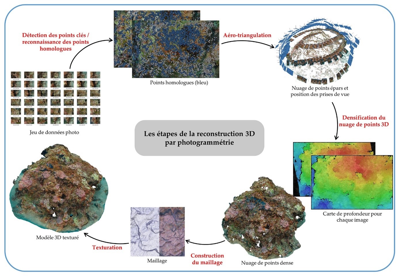
The stages of 3D reconstruction by photogrammetry
The 3D acquisitions can then be used for several purposes :
- Produce an orthomosaic of the digitized area, for cartographic purposes ;
- Produce local views of the 3D model, allowing for monitoring to produce “permanent quadrats” (i.e. identical views from one monitoring to the next), useful for precisely monitoring the evolution of a necrosis or recolonization zone of a reef for example ;
- To use the positioning of the images, in particular to locate the RECOR quadrats made on the 3D digitized reefs ;
- Study the 3D structure of the models themselves : volume measurements, 3D surfaces, growths, structural complexity indicators (fractal dimension, roughness…) ;
- Banking of the state of a habitat or a submerged structure at a time t : unlike other acquisition methods, photogrammetry allows to “freeze” in an almost exhaustive way the state of a habitat or a structure at a time t. The images and 3D models allow us to “go back” to measure or identify something that was not the subject of study at the time of acquisition.
For more details, you can consult the platform by clicking on the button “Access the maps“, just below.
© Andromède Océanologie
Contact : Guilhem Marre (guilhem.marre@andromede-ocean.com)
Project Leader : Andromède Océanologie – andromede-ocean
Update frequency : Annual
Partners : Rhone Mediterranean and Corsica Water Agency
Study reports

Associated scientific publications