MONITORING OF CORALLIGENOUS ASSEMBLAGES IN THE FRENCH MEDITERRANEAN
The RECOR monitoring network, initiated in 2010, concerns the monitoring of coralligenous assemblages. It is operated by Andromède Océanologie with the support of the Rhone Mediterranean and Corsica Water Agency and OSU-OREME. It covers the entire French Mediterranean coastline bordered by three regions : Corsica, the South region, and Occitania. The objectives of this network are to collect descriptive data on the state and functioning of coralligenous assemblages according to an adapted and standardized methodology and to follow their evolution in time and space. This network is in line with Article 8 of the European Directive 2000/60/EC of October 23, 2000, since it completes the status of marine waters (also required by the Marine Strategy Framework Directive (MSFD, 2008/56/EC)) and also meets the obligations of the monitoring program of the Marine Environment Action Plan of the Western Mediterranean sub-region.
On the French and Monegasque Mediterranean coast (between Banyuls and Menton), RECOR includes 130 sites corresponding to 207 stations (one station = one depth) distributed between 17 and 120 meters deep (october 2024). This network also extends into foreign Mediterranean waters such as Sardinia (Italy). A total of 677 coralligenous reef monitoring surveys have been carried out between 2010 and 2024. Each year, a French region is monitored at the end of spring (may-june) in order to cover the whole coastline every three years. All RECOR sites are also subject to bottom temperature monitoring (CALOR network), 3D modeling using photogrammetry (MODEL network), and some to fish monitoring (PISCIS network) and acoustic listening (CALME network operated by Chorus). Indicators of the bioacoustic status of coralligenous sites (invertebrates, fish, target species (=corbs) and anthroposation index) over the period 2021-2023 from this CALME network are added to the project.
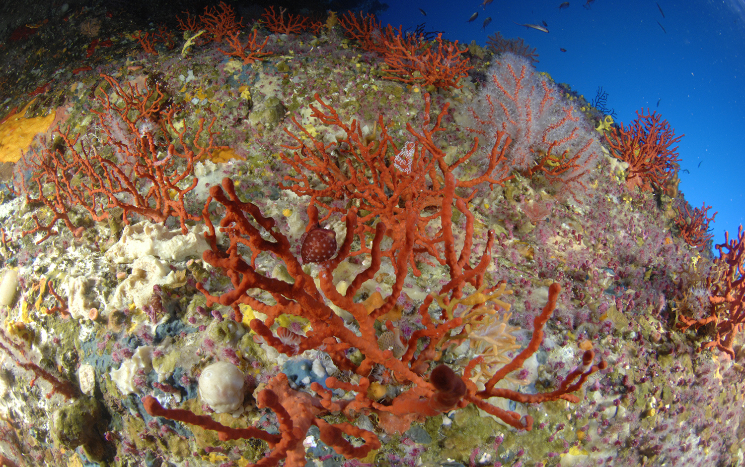
The « Agriates_Sud » Coralligenous site off the Agriates Desert in Corsica (Laurent Ballesta ©, 2020)
On the basis of a bibliographical synthesis dealing with the coralligenous and a comparison with the studies and methodologies carried out in the coral environment (more than 70 international publications and reports), we take into account three types of descriptors for the monitoring of the coralligenous communities : a general description of the site (abiotic factors), the visible fixed species and the demography of the erected species. A descriptive brochure (Material and methods) of this monitoring network is available on the website.
At each sampling station, 30 photographs of 50 x 50 cm quadrats are taken using a Nikon D810 camera (24×36 mm sensor, 36.3 million pixel resolution) at the same depth along a 20 m transect (Deter et al., 2012b). During photo analysis, CPCe software randomly distributes 64 points across each quadrat. Identifying the nature of the species or substrate on which these points are placed allows calculation of percent cover by different substrates and taxa (Deter et al., 2012b, 2012a).
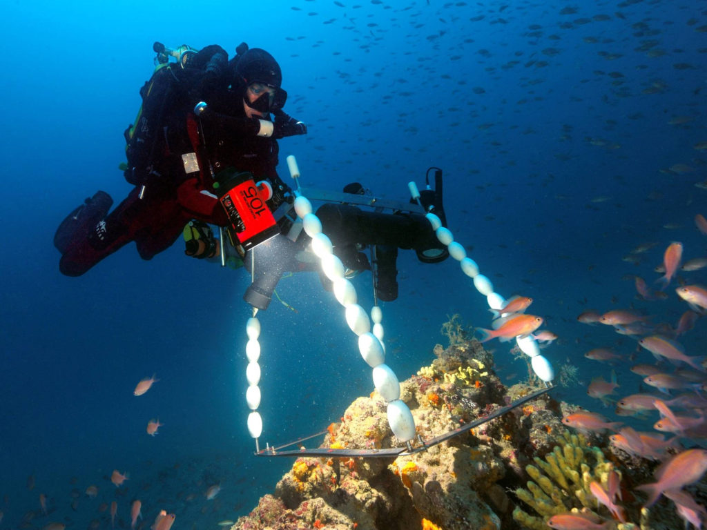
Illustration of the quadrat photography method (© Andromède océanologie).
About 100 quantitative variables are extracted from these results : percentages of total cover by non-living (cavities, substrates (mud, sand, rock), biological debris, macro-waste) and living, and the relative proportions of different taxa/categories of interest among the living. In all, over 180 species and 32 genera can be identified.
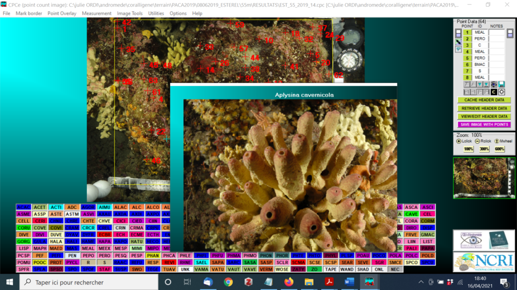
Photographic quadrat being analyzed with CPCe software with random positioning of 64 points (© Andromède océanologie).
For each RECOR station, all these data are summarized through : (1) the 30 photographic quadrats ; (2) a table detailing about forty variables from the analysis of these quadrats (for each detailed parameter a pictorial cursor places the observed value in the regional context (minimum, maximum and average values observed on all the sampled sites) ; (3) a diagram of the distribution of the different taxa among the living organisms (relative abundance). At each site we estimate the density, size structure and status of erect species (gorgonians) to monitor the health of the populations.
In the RECOR mapping project (click on “Access to maps”), you can access the complete ‘Coralligenous’ (analysis of photographic quadrats) and ‘Gorgonian’ (demography of erect species) monitoring sheets, as well as the bioacoustic status indicators by clicking on the acoustic monitoring stations.
.
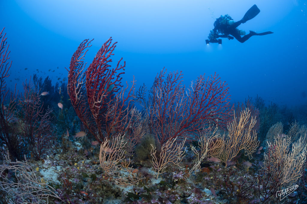
The demography of erect species (mainly gorgonians such as Paramuricea clavata) is carried out on each RECOR site : density, size structure and state of the species (necrosis) (Laurent Ballesta ©, 2020)
The CPCe (Coral Point Count with Excel extensions) “Coralligenous assemblages version” program is a Windows-based software package (PC use only) that provides a tool for determining coralligenous cover using transect photographs. A specified number of random points in space are distributed over a transect image, and the features underlying the points are identified by the user. Coverage statistics are then calculated and the results automatically sent to Excel spreadsheets.
You can download the program right here! “CPCe 4.1 coralligenous assemblages version“
CPCe can also be used for image calibration and benthic zone analysis. Excel sheets are automatically generated to summarize surface calculations for each image.
CPCe is simple and straightforward to use. The main form is where the transect photograph and taxon codes are displayed. The main form includes the following menu items: File, Mark Border, Point Overlay, Measurement, Image Enhancement, Utilities, Options and Help.
This version is an extension of the classic version CPCe developed for coral reefs (https://nsuworks.nova.edu/software/2/).
Contacts : Gwenaëlle Delaruelle (gwenaelle.delaruelle@andromede-ocean.com) / Julie Deter (julie.deter@andromede-ocean.com)
Project leader : Andromède Océanologie – andromede-ocean
Update frequency : Annual monitoring by region (each region, Occitanie/PACA West, PACA East and Corsica, is monitored every three years).
Partners : Rhone Mediterranean and Corsica Water Agency and OSU-OREME
Study reports

Associated scientific publications
• A Visual Basic program for the determination of coral and substrate coverage (Kohler & Gill 2006)
• New multidimensional functional diversity indices (Villéger et al., 2008)
• An index based on coralligenous assemblages : CAI (Deter et al., 2012)
• A photographic method detects depth gradient in coralligenous (Deter et al., 2012)
• Mapping biodiversity in three-dimensions challenges marine conservation strategies (Doxa et al., 2015)
• Fine-Scale Cartography of Human Impacts along French Mediterranean Coasts (Holon et al., 2015)
• Interactions entre écosystèmes marins et pressions anthropiques (Holon 2015)
• Taxonomic and functional diversity increase the aesthetic value of coralligenous reefs (Tribot 2016)
• Esthétique et Biodiversité des écosystèmes sous-marins (Tribot 2017).
• Integrating the aesthetic value of landscapes and diversity (Tribot et al., 2018)
• Deep convolutional neural networks to monitor coralligenous (Marre et al., 2020).